
TZ MAPS is the new offer for your Official Detailed Nautical Charts
What makes TZ MAPS different from MM3D nautical charts, and what is the added value of switching to TZ MAPS?
Good news! Your nautical chart has been updated! You need the update to ensure you have the latest and most reliable information available to enhance your safety and enjoyment out on the water.
For many years, you have been updating your chart in the same format, either Raster or Vector, with a 50% discount off the full retail price. And you can still do that! But you’ve also heard about all of TZ MAPS revolutionary capabilities, so you might be wondering what to do. There is no bad choice, but an informed decision will allow you to get the best value that meets your specific needs, and possibly a great deal that you were not expecting. Indeed, although the first one-year purchase is full price, TZ MAPS preferential renewal rate is much cheaper than MM3D discounted updates. Everything is explained on this page; we are here to help!
TZ MAPS is not a new name for MM3D nautical charts
TZ MAPS is not a cooler name for the same MM3D nautical charts. But then, what is the difference? Well, there are many!
Let’s start with what might be the major difference if you are considering the best option to update your nautical chart right now. TZ MAPS doesn’t only offer the latest data available today for your chart format in your area, as MM3D does. TZ MAPS offers continuous updates of all the available chart formats for your area for 12 months.
This means you will have access to both Vector and Raster* charts, in addition to detailed land information, high-resolution satellite photos*, and high-resolution Bathymetry** for your area.
It also means that you get access to all these complementary charts for safe navigation for the price of a single TZ MAPS area instead of multiple MM3D charts for the same coverage, resulting in a much better deal (which gets even better after your initial one-year purchase, keep reading to the end for this tip).
Finally, TZ MAPS offer of continuous updates for 12 months doesn’t just mean safer conditions at sea at any time of the year (no more waiting for updated charts); it also makes your budget more predictable, instead of incurring multiple update costs for the same area over the same period.
What does not change is the chart data and integration quality! TZ MAPS brings more than an unparalleled chart pack at an affordable price. TZ MAPS brings significant additional value by introducing new cutting-edge features thanks to the valued feedback of our users and our strong innovation capabilities.
Access a new range of exclusive advanced features with TZ MAPS
TZ MAPS is so much more than your average chart update - it's a comprehensive and revolutionary navigational tool packed with advanced features that will transform your marine experience. Here's why TZ MAPS is a game-changer:
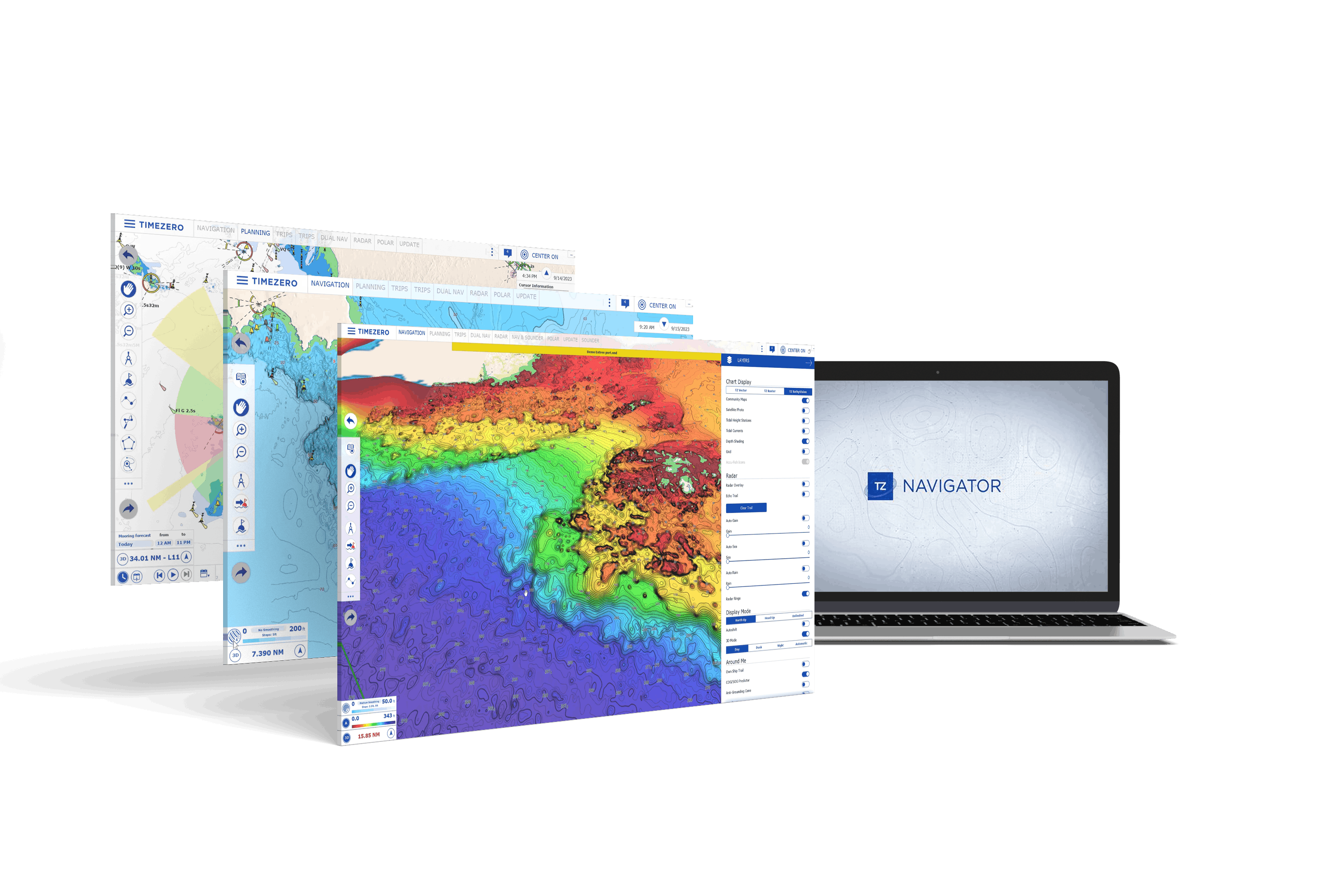
1 BathyVision
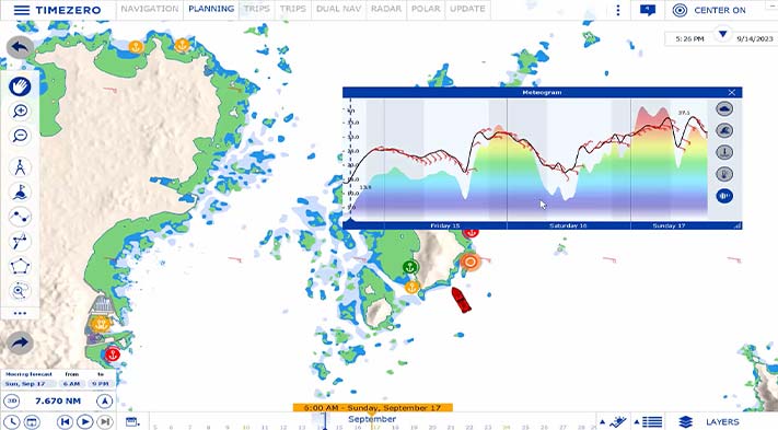
offers the best bottom data available and lets you display it dynamically and intuitively in color and/or with contour lines. It is possible to configure the density of contour lines and associated shading to focus very precisely on high-potential fishing areas.
2 Dynamic Lights
intuitively represent the light sectors according to your boat’s position and field of vision. It can also flash the navigation lights on the chart according to your position. Only lights within your actual field of vision are shown as highlighted and flashing.
3 Dynamic Moorings
guides you to the safest anchoring spot, taking into account real-time weather data and other critical information, helping you anchor safely and with peace of mind.
4 Community Maps
gives you access to a wealth of community knowledge through these crowd-sourced charts and allows you to contribute to the marine chart data in your navigation area. These charts are the perfect way to share expert knowledge, discovering hidden gems, and helping other boaters to avoid dangerous predicaments.
5 Smart Search
makes it easy to find what you need quickly with this built-in high-performance search engine. Whether you’re looking for a specific location, buoy, tide station, or other information on your charts, this feature will help simplify the process and take you directly to your target on the nautical chart.
6 Smart Zones
helps you stay on the right course by creating an alarm to let you know when your boat enters or leaves specific areas on the nautical charts, such as a restricted or forbidden area. Configure the type to suit your preferences, and display NavData to see a list of all zones in which your boat is located.
7 Route Assist
revolutionizes route creation by allowing you to automatically generate a navigation route between two points, saving you valuable time and effort in planning and preparation. Additionally, Route Assist lets you customize the route after it’s created, giving you complete control and the flexibility to tailor your journey to your exact needs. Route Assist is for planning purposes only and does not replace safe navigation operations.
+ TIMEZERO Ecosystem: When you purchase a TZ MAPS area for your TIMEZERO PC software, you can use it for free on our iOS application TZ iBoat with up to 5 devices (iPhone or iPad)!
Compare MM3D and TZ MAPS capabilities in a glimpse
Detailing TZ MAPS new capabilities, uses and advantages could be endless and there will be nothing like experiencing it by yourself. But a clear comparison table might help you see the benefits by switching from MM3D.
Nautical Charts, Data, and Features | MM3D | MAPS |
|---|---|---|
| Chart(s) | Raster OR Vector | Raster* AND Vector |
| Detailed land information data | ||
| High-resolution satellite photos | * | |
| High-resolution Bathymetry data | ** | |
| Chart data updates | Usually available once a year, one-shot purchase | Continuous automatic updates for 12 months |
| BathyVision feature | ||
| Route Assist feature | ||
| Community Maps feature | ||
| Dynamic Lights feature | ||
| Dynamic Moorings feature | ||
| Smart Search feature | ||
| Smart Zones feature | ||
| TZ iBoat iOS app unlock | ||
| Coverage | Worldwide | Most of Americas, Europe, Australia, New Zealand, Japan, South Africa, and French Polynesia-New Caledonia |
| Compatibility | All TZ PC software and Furuno NavNet systems | V5 of TZ PC software, TZ iBoat app, and Furuno NavNet TZtouchXL |
Renew your MM3D chart or switch to TZ MAPS?
Now that you are aware of the differences between the two offerings and the additional value of TZ MAPS, you might prefer one or the other option depending on your specific needs. However, we encourage all MM3D users to switch to TZ MAPS, our improved range of official, detailed nautical charts, to ensure the safest and most up-to-date navigation system at any time.
TZ MAPS includes all available charts for a region, for a single, affordable price.
Check TZ MAPS chart areas available
Note that previously downloaded chart data will remain usable in your TIMEZERO PC software, so you can smoothly transition to new data and capabilities.
With TZ MAPS, you will receive unlimited, automatic chart updates to ensure that you always have the latest data at your fingertips. This includes Raster* & Vector charts; BathyVision; and Community Charts.
Besides safety, price is undoubtedly a significant criteria we’ve got you covered there too!
Affordable price thanks to a new annual subscription offer:
Despite its advanced features and regular updates, TZ MAPS is available at an affordable price, making it accessible to mariners of all levels. With TZ MAPS, you're guaranteed unparalleled value for your money, thanks to the TZ MAPS preferential renewal rate being cheaper than MM3D discounted updates.
The annual subscription is available to all customers after their initial one-year purchase of TZ MAPS in each navigation area. It provides access to all the innovative features, along with continuous updates of all available chart data in the area.
Let’s run a quick estimation of what that means in two different areas:
Chart offers: | MM3D renewal | New TZ MAPS |
Sailing to Guadeloupe? | Central America & Caribbean | Central America & Caribbean |
|
|
|
Sailing to the French Riviera? | Mediterranean and Black Sea | Western Mediterranean |
|
|
|
TZ MAPS renewal is not full price after the initial year, and even cheaper than MM3D 50% discount updates. That’s why, in both of the above cases, whether it takes until the third year or even right away, switching to TZ MAPS is the smartest deal, and you will enjoy Raster, Vector, detailed land information, high-resolution satellite photos, and high-resolution Bathymetry all integrated for your navigation area.
Of course, these are specific simulations for specific destinations. It might take longer for TZ MAPS to be a better deal if, for example, you are crossing the Mediterranean from Gibraltar to Cyprus in less than a year, and you don’t want Raster or Bathymetry charts (which might result in lower safety). That’s why we are happy to help you with your specific estimate, so you can get the best deal, either with MM3D or TZ MAPS, for your own needs! In that case, please contact your local dealer or get in touch with us.
Unlock amazing features and take advantage of this great opportunity to update your nautical chart, explore new destinations, and become an active member of the TIMEZERO sailors & boaters community!
If you would like to purchase a TZ MAPS chart zone for the first time, please visit our webstore or the “TZ MAPS Store” menu in your TIMEZERO PC software, contact your local dealer, or contact us.
* Raster Charts and High-Resolution satellite photos are not available in all areas.
** BathyVision resolution varies according to areas. In some cases, high-resolution data is mixed with low-resolution data to produce a more complete composite image.
*** The prices shown in the table are therefore shown for informational purpose only and can be subject to change.