How to subscribe to TZ MAPS, the latest version of your official detailed nautical maps on your TZ iBoat application?
TZ iBoat introduces a revolutionary TZ MAPS, a new nautical map format that combines several types of data: Raster, Vector, detailed land information, high-resolution satellite photos, high resolution Bathymetry and new great features that will quickly become indispensable to you! Discover all the new features on this page. The old map format is no longer updated on our server. We show you how to subscribe to the latest version of your official detailed nautical maps on your TZ iBoat application to benefit from the whole TZ MAPS offer and keep your maps up to date.
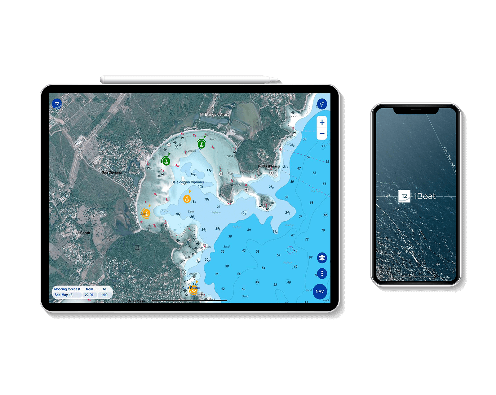
TZ iBoat introduces TZ MAPS, a revolutionary new map format that combines several data types: Raster, Vector, detailed land information, high-resolution satellite photos, high resolution Bathymetry in addition to new advanced features!
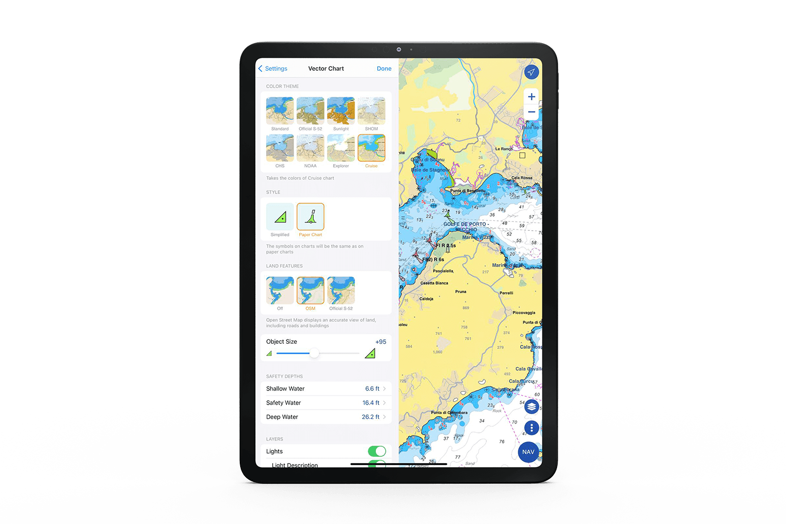
TZ MAPS uses official hydrographic data and complements it with high resolution and dynamic data. Each zone includes both vector data and raster maps (scanned and georeferenced paper maps). A fantastic way to compare data and make sure you get the best information available.
Your new maps are now high resolution! In some areas, you can even see depth shading and maps become dynamic.
By switching to TZ MAPS, you will now have the ability to contribute to the map data of your navigation area by commenting, noting, voting, modifying or deleting objects such as buoys and obstructions or points of interest (restaurants and supply stores) in a participative way with the rest of the TIMEZERO community. Benefit from the most reliable and precise information!
Explore your maps like never before! With smooth images, new text display, optimized presets and better data integration, your navigation area will never cease to amaze you! We have put considerable effort into developing our color palettes, providing users with a very pleasant display that is both user-friendly and easy to interpret. In addition, our maps now offer more detailed land information, providing better insight into the coastline and surrounding infrastructure. You can even customize the color palette of your TZ MAPS to enhance your navigation experience and make it your own!
Discover all the new features that await you with your TZ MAPS on TZ iBoat in video.
I’m on my computer, how to subscribe to TZ MAPS on TZ iBoat
TZ iBoat requires a smartphone or a tablet. To subscribe to TZ MAPS, open the app on either of these devices and press the TZ button at the top left of your screen to select "Store".
When you purchase a zone, regular updates are included for one year. To update your maps, nothing could be simpler, just click on the "update" button available in all our products. After one year, you can choose to subscribe to our permanent update service.
I’m on my smartphone/tablet but TZ iBoat doesn’t open
Is the TZ iBoat app installed on your smartphone/tablet? If in doubt, click on this link. If the app is installed correctly, check the iOS&Android version. TZ iBoat requires an iPhone or an iPad (with iOS 14.2 or higher). If you experience a bug, try restarting your device and/or uninstalling and reinstalling the application. Of course, you can contact the technical support team at any time.