Explore our directory of detailed Raster and Vector charts for TZ iBoat
Download TZ iBoat and gain access to our TZ MAPS chart offering. Choose from 21 navigation areas and unlock a powerful combination of chart data in one place: Vector charts (all areas), Raster charts (selected areas), detailed land information, high-resolution satellite photos, and high-resolution bathymetry.
Don’t limit yourself! Get the chart coverage you need directly in one app and compare Raster and Vector data for unmatched detail and precision in your navigation area. Your charts stay current with automatic updates to the latest available data during your subscription. Purchase a subscription (*) for one or several chart areas directly from your TZ iBoat – Marine Navigation app.
(*) The App Stores govern the prices of our charts and modules. The prices shown below are therefore shown for information only and can be subject to change.
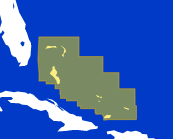
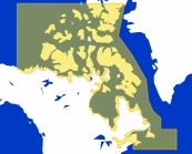
Bahamas
Bahamas & Turks and Caicos Islands.
Including several types of data: Raster, Vector, detailed land information, high-resolution satellite photos, high resolution Bathymetry.
Yearly Subscription: $30.99
USA
US Coast including Alaska, Hawaii, Great Lakes, USACE Inland Rivers, Mariana Islands, American Samoa, Palau Islands, Marshall Islands.
Including several types of data: Raster, Vector, detailed land information, high-resolution satellite photos, high resolution Bathymetry.
Yearly Subscription: $19.99
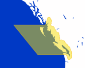
Canada West
Canada West Coast.
Including several types of data: Raster, Vector, detailed land information, high-resolution satellite photos, high resolution Bathymetry.
Yearly Subscription: $19.99
Canada East and North
Canada East and North.
Including several types of data: Raster, Vector, detailed land information, high-resolution satellite photos, high resolution Bathymetry.
Yearly Subscription: $19.99
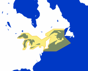
Great Lakes
Great Lakes, St Lawrence River to New York.
Including several types of data: Raster, Vector, detailed land information, high-resolution satellite photos, high resolution Bathymetry.
Yearly Subscription: $19.99
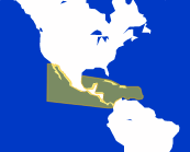
Central America & Caribbean
Mexico to Panama ; from Cuba to Grenada.
Including several types of data: Raster, Vector, detailed land information, high-resolution satellite photos, high resolution Bathymetry.
Yearly Subscription: $30.99
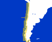
Chile
Chile.
Including several types of data: Vector, detailed land information, high resolution Bathymetry.
Yearly Subscription: $40.99
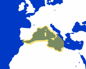
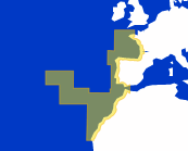
Western Mediterranean
Western Italy, Southern France, Eastern Spain, Strait of Gibraltar, Northern Morocco, Algeria, Balearic Is. Sardinia & Corsica.
Including several types of data: Raster, Vector, detailed land information, high-resolution satellite photos, high resolution Bathymetry.
Yearly Subscription: $40.99
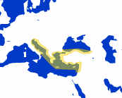
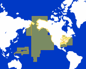
Eastern Mediterranean
Eastern Italy, Croatia, Greece, Malta, Turkey, Lebanon including Crete and Cyprus.
Including several types of data: Vector, detailed land information, high-resolution satellite photos, high resolution Bathymetry for the whole area. Including Raster data for Greece only.
Yearly Subscription: $61.99
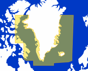
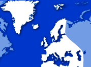
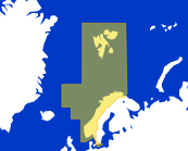
Iceland, Greenland, Faroe Islands
Iceland, Greenland and Faroe Islands.
Including several types of data: Raster, Vector, detailed land information, high resolution Bathymetry.
Yearly Subscription: $92.99
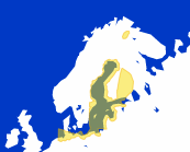
Norway
Norway.
Including several types of data: Raster, Vector, detailed land information, high-resolution satellite photos, high resolution Bathymetry.
Yearly Subscription: $40.99
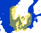
Baltic Sea
Germany, Poland, Lithuania, Latvia, Estonia, East of Sweden, Finland.
Including several types of data: Vector, detailed land information, high-resolution satellite photos, high resolution Bathymetry for the whole area. Including Raster data for Kiel canal & Helgoland only.
Yearly Subscription: $61.99
Skagerrak & Kattegat
Germany, South of Norway, Denmark, East of Sweden.
Including several types of data: Vector, detailed land information, high-resolution satellite photos, high resolution Bathymetry for the whole area. Including Raster data for Kiel canal & Helgoland only.
Yearly Subscription: $92.99
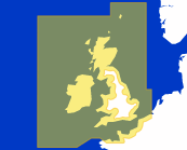
UK, Ireland & the Channel
United Kingdom, Ireland, English Channel.
Including several types of data: Raster, Vector, detailed land information, high-resolution satellite photos, high resolution Bathymetry.
Yearly Subscription: $40.99
Europe West
Atlantic French coast, North Spain, Portugal, Morocco including Azores, Madeira, Canary Islands.
Including several types of data: Raster, Vector, detailed land information, high-resolution satellite photos, high resolution Bathymetry.
Yearly Subscription: $40.99
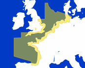
Europe North-West
Germany, Netherlands, English Channel, Atlantic French coast.
Including several types of data: Raster, Vector, detailed land information, high-resolution satellite photos, high resolution Bathymetry.
Yearly Subscription: $40.99
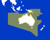
Australia
Australia including, Papua New Guinea, Tasmania, Salomon, Cocos Islands.
Including several types of data: Vector, detailed land information, high-resolution satellite photos, high resolution Bathymetry.
Yearly Subscription: $30.99
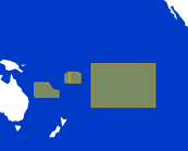
French Polynesia-New Caledonia
Society Is, Tubai, Wallis and Futuna, Archipelago Des Tuamotu, Gambier Is, Marquises Is, New Caledonia, Loyauté Is.
Including several types of data: Raster, Vector, detailed land information, high resolution Bathymetry.
Yearly Subscription: $30.99
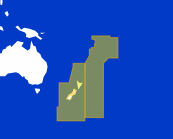
New-Zeland, Fiji
New-Zealand including Chatham, Kermadec, Auckland, Samoa, Cooks, Tonga islands, Fiji.
Including several types of data: Vector, detailed land information, high-resolution satellite photos, high resolution Bathymetry.
Yearly Subscription: $30.99
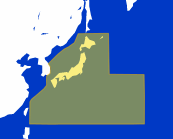
Japan
Japan.
Including several types of data: Vector, detailed land information, high resolution Bathymetry.
Yearly Subscription: $61.99
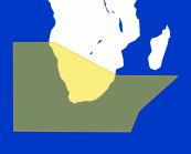
South Africa
South Africa and Namibia.
Including several types of data: Vector, detailed land information, high resolution Bathymetry.
Yearly Subscription: $40.99
Nautical charts Subscription Information
To subscribe to TZ MAPS, open the app on your iPhone or iPad, press the TZ button at the top left of your screen and select "Store".
Chart purchase is a one-year subscription, and regular updates are included for the subscription duration. To update your maps, nothing could be simpler, just click on the "update" button. You can download detailed maps by zooming in (streaming the data) or by caching areas from the "Manage Chart" screen (for offline access).
After one year, you can choose to subscribe to our permanent update service. The subscription will be renewed automatically! If you choose to cancel the subscription, charts will remain on your device even after expiration with the last update done during the subscription period.
Free | Essential | Premium | Elite | |
|---|---|---|---|---|
Monthly: | Monthly: | Monthly: | ||
Start exploring with confidence | ||||
Real-time onboard integration | ||||
Navigate with advanced weather intelligence | ||||
Unlock advanced ocean intelligence for Sportfishing | ||||
The subscription renews automatically, it can be managed through your account settings after purchase.
Radar Module
This in-app purchase allows you to display the Furuno 1st Watch Wireless Radar (DRS4W purchased separately) on top of the chart. Go to TIMEZERO> Initial Setup> Radar Demo menu to watch a demo.
Price From: $49.99

Sounder Module
This in-app purchase makes TZ iBoat compatible with Furuno’s FCV-600 and FCV-800 Fish. It allows you to display remotely sounder image via Wireless LAN. You will enjoy the same controls from anywhere on the boat through the iOS app.
Price From: $24.99
Check out the most frequently asked questions
or contact our dedicated support team.


Download TZ iBoat - Marine Navigation!