How to subscribe to TZ MAPS, the Latest Preferential Rate of Your Official Detailed Nautical Charts?
TZ MAPS combines several types of nautical chart data: Raster, Vector, detailed land information, high-resolution satellite photos, high-resolution Bathymetry. But that’s not all, it also gives you access to innovative features developed thanks to this revolutionary chart technology: continuous update of chart data, bottom data via BathyVision, Route Assist, Community Edit, Dynamic lights, and Anchor Alarm, for a smooth trip out to sea and back to port every time.
After your first one-year purchase of TZ MAPS in your navigation area, upgrade to the preferential rate for your official detailed charts. We show you how to subscribe to benefit from the whole TZ MAPS offer at the best rate and keep your nautical charts up to date.
The annual subscription is available to all customers after their initial one-year purchase of TZ MAPS in each navigation area. It provides access to all the innovative features, along with continuous updates of all available chart data in the area.
TZ MAPS chart data includes: Raster1, Vector, detailed land information, high-resolution satellite photos1, high-resolution Bathymetry.
TZ MAPS exclusive features include: BathyVision2, Dynamic Moorings, Community Maps, Dynamic Lights, Smart Search, Smart Zones, and Route Assist3.
If you would like to purchase a TZ MAPS chart zone for the first time, please visit our webstore or the “TZ MAPS Store” menu in your TIMEZERO PC software, contact your local dealer or get in touch with us.
- Raster Charts and High-Resolution satellite photos not available in all areas.
- BathyVision resolution varies according to areas. In some cases, high-resolution data is mixed with low-resolution data to produce a more complete composite image.
- Route Assist is for planning purposes only and does not replace safe navigation operations.
Discover our directory containing 19 areas of official detailed nautical charts. The chart areas automatically update themselves with the latest data available.
(*) The prices shown below are therefore shown for information only and can be subject to change.
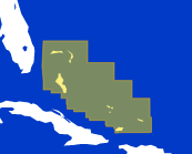
Bahamas
Bahamas & Turks and Caicos Islands.
Including several types of data: Raster, Vector, detailed land information, high-resolution satellite photos, high resolution Bathymetry.
Yearly Subscription: $30.99
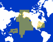
USA
US Coast including Alaska, Hawaii, Great Lakes, USACE Inland Rivers, Mariana Islands, American Samoa, Palau Islands, Marshall Islands.
Including several types of data: Raster, Vector, detailed land information, high-resolution satellite photos, high resolution Bathymetry.
Yearly Subscription: $19.99
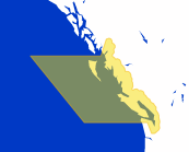
Canada West
Canada West Coast.
Including several types of data: Raster, Vector, detailed land information, high-resolution satellite photos, high resolution Bathymetry.
Yearly Subscription: $19.99
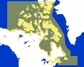
Canada East and North
Canada East and North.
Including several types of data: Raster, Vector, detailed land information, high-resolution satellite photos, high resolution Bathymetry.
Yearly Subscription: $19.99
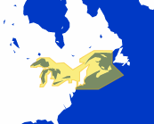
Great Lakes
Great Lakes, St Lawrence River to New York.
Including several types of data: Raster, Vector, detailed land information, high-resolution satellite photos, high resolution Bathymetry.
Yearly Subscription: $19.99
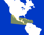
Central America & Caribbean
Mexico to Panama ; from Cuba to Grenada.
Including several types of data: Raster, Vector, detailed land information, high-resolution satellite photos, high resolution Bathymetry.
Yearly Subscription: $30.99
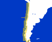
Chile
Chile.
Including several types of data: Vector, detailed land information, high resolution Bathymetry.
Yearly Subscription: $30.99
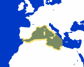
Western Mediterranean
Western Italy, Southern France, Eastern Spain, Strait of Gibraltar, Northern Morocco, Algeria, Tunisia, Balearic Is. Sardinia & Corsica.
Including several types of data: Raster, Vector, detailed land information, high-resolution satellite photos, high resolution Bathymetry.
Yearly Subscription: $40.99
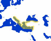
Eastern Mediterranean
Eastern Italy, Croatia, Greece, Turkey, Lebanon including Crete and Cyprus.
Including several types of data: Vector, detailed land information, high-resolution satellite photos, high resolution Bathymetry for the whole area. Including Raster data for Greece only.
Yearly Subscription: $61.99
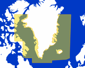
Iceland, Greenland
Iceland and Greenland.
Including several types of data: Raster, Vector, detailed land information, high resolution Bathymetry.
Yearly Subscription: $92.99
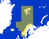
Norway
Norway.
Including several types of data: Raster, Vector, detailed land information, high-resolution satellite photos, high resolution Bathymetry.
Yearly Subscription: $40.99
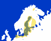
Baltic Sea
Germany, Poland, Lithuania, Latvia, Estonia, East of Sweden, Finland.
Including several types of data: Vector, detailed land information, high-resolution satellite photos, high resolution Bathymetry for the whole area. Including Raster data for Kiel canal & Helgoland only.
Yearly Subscription: $61.99
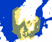
Skagerrak & Kattegat
Germany, South of Norway, Denmark, East of Sweden.
Including several types of data: Vector, detailed land information, high-resolution satellite photos, high resolution Bathymetry for the whole area. Including Raster data for Kiel canal & Helgoland only.
Yearly Subscription: $92.99
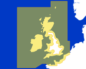
UK, Ireland & the Channel
United Kingdom, Ireland, English Channel.
Including several types of data: Raster, Vector, detailed land information, high-resolution satellite photos, high resolution Bathymetry.
Yearly Subscription: $40.99
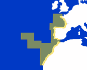
Europe West
Atlantic French coast, North Spain, Portugal, Morocco including Azores, Madeira, Canary Islands.
Including several types of data: Raster, Vector, detailed land information, high-resolution satellite photos, high resolution Bathymetry.
Yearly Subscription: $40.99
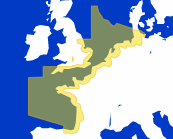
Europe North-West
Germany, Netherlands, English Channel, Atlantic French coast.
Including several types of data: Raster, Vector, detailed land information, high-resolution satellite photos, high resolution Bathymetry.
Yearly Subscription: $40.99
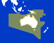
Australia
Australia including, Papua New Guinea, Tasmania, Salomon, Cocos Islands.
Including several types of data: Vector, detailed land information, high-resolution satellite photos, high resolution Bathymetry.
Yearly Subscription: $30.99
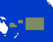
French Polynesia-New Caledonia
Society Is, Tubai, Wallis and Futuna, Archipelago Des Tuamotu, Gambier Is, Marquises Is, New Caledonia, Loyauté Is.
Including several types of data: Raster, Vector, detailed land information, high resolution Bathymetry.
Yearly Subscription: $30.99
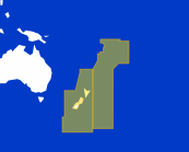
New-Zeland
New-Zealand including Chatham, Kermadec, Auckland, Samoa, Cooks, Tonga islands.
Including several types of data: Vector, detailed land information, high-resolution satellite photos, high resolution Bathymetry.
Yearly Subscription: $30.99
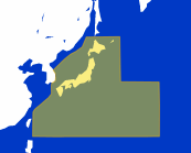
Japan
Japan.
Including several types of data: Vector, detailed land information, high resolution Bathymetry.
Yearly Subscription: $61.99
To take advantage of the TZ MAPS annual subscription, you must first make your first one-year purchase of TZ MAPS in the nautical chart zone in question. The option to purchase the annual subscription opens 15 days before the end date of this first year (note that the one-year subscription begins on the day of purchase).
If you are eligible for the TZ MAPS annual subscription offer for your desired nautical chart area, you have several options.
From your TIMEZERO PC software:
Open the software on your PC and click on the TIMEZERO menu in the top left-hand corner. Go to the “TZ MAPS Store” section to access the preferential annual subscription rate, and let us guide you through the activation process.
Go to the navigation zone in question. Once the first year has elapsed, a window will automatically appear when you try to download a chart update or use one of TZ MAPS' exclusive features in the zone. This window will inform you of the preferential annual subscription rate and guide you through the activation process.
From your MyTIMEZERO portal:
Log in to your MyTIMEZERO account from any web browser and access your TIMEZERO license. You'll be able to view all your products and, once your first year on the TZ MAPS chart zone is up, decide whether to upgrade to the corresponding annual subscription offer.
From our webstore:
Visit our Webstore from any Internet browser and log in with your TIMEZERO license number. Once you have completed your first year on the TZ MAPS chart zone, you will automatically be offered the corresponding annual subscription. Select it and let us guide you through its activation.
Once your TIMEZERO subscription has been activated, updating your nautical charts is as simple as clicking on the “update” button, just as you did in the first year. You can download detailed charts by zooming in (streaming data) or by caching areas from the “Manage Chart” window in the software (for offline access).
After one year, the subscription will automatically renew. If you decide to cancel, the chart data from your last update before the subscription expires will remain on your device.
