TIMEZERO premium oceanography service for great performance
TZ Professional introduces the new Premium Ocean-O service for pelagic fishing. It provides higher resolution and a new type of multi-layer data. This service is geared towards commercial fishermen and advanced sport fishermen who want to target best fishing potential spots. Discover all the great tools available in the new Ocean-O workspace including advanced parameters and presets.
Manage your fishing spots with extreme precision and the most accurate data
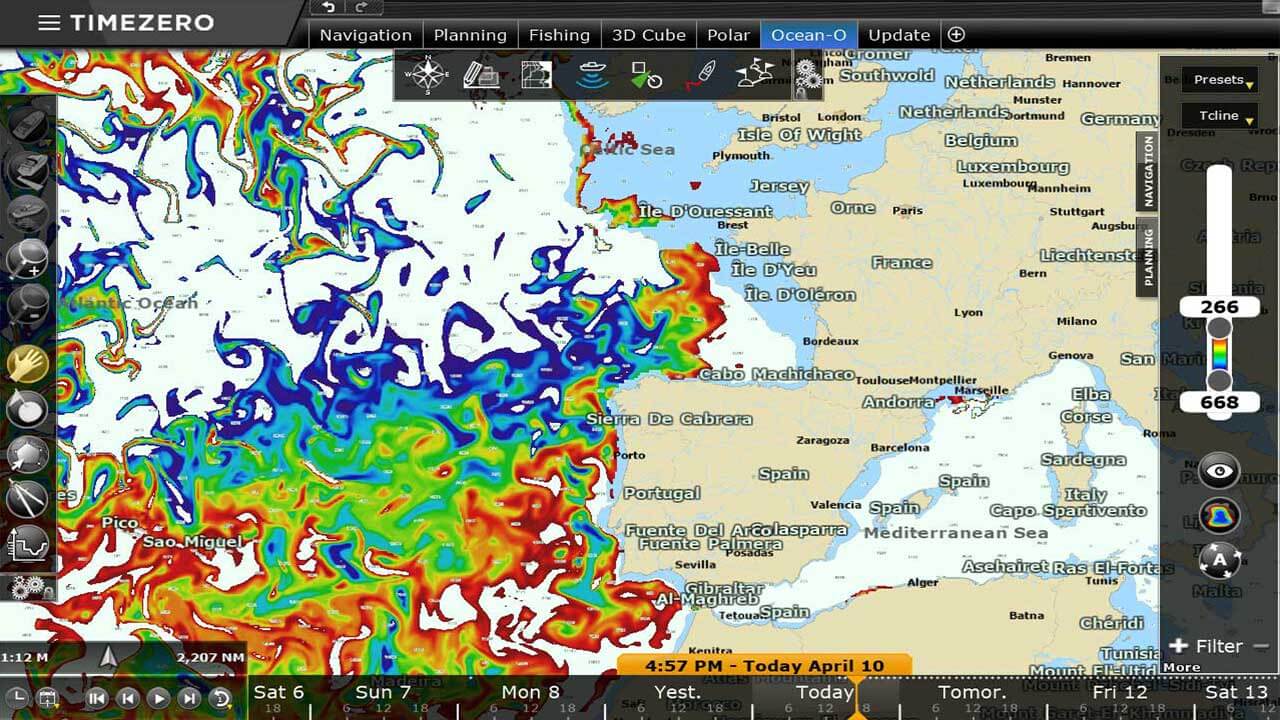
High resolution oceanographic forecast in TIMEZERO
Oceanography is a science that studies various aspects of oceans and seas, including ocean currents, marine organisms and ecosystems, as well as the links between oceans and climate change.
The oceanographic forecasts available in TZ Professional are intended for pelagic fishing. They aim to define the best fishing areas. Indeed, pelagic species move according to different parameters such as altimetry, surface temperature or currents.
TZ Professional is the only system that offers multi-day oceanographic forecasts. This is particularly interesting as conditions may change between the time of departure and the time of arrival in the fishing area. TZ Professional allows you to go directly to the area with the best fishing potential!
TZ Professional becomes a key decision support tool for pelagic fisheries.
Do not launch your fishing campaigns at random! TZ Professional's Ocean-O saves you time and optimizes your fuel costs.
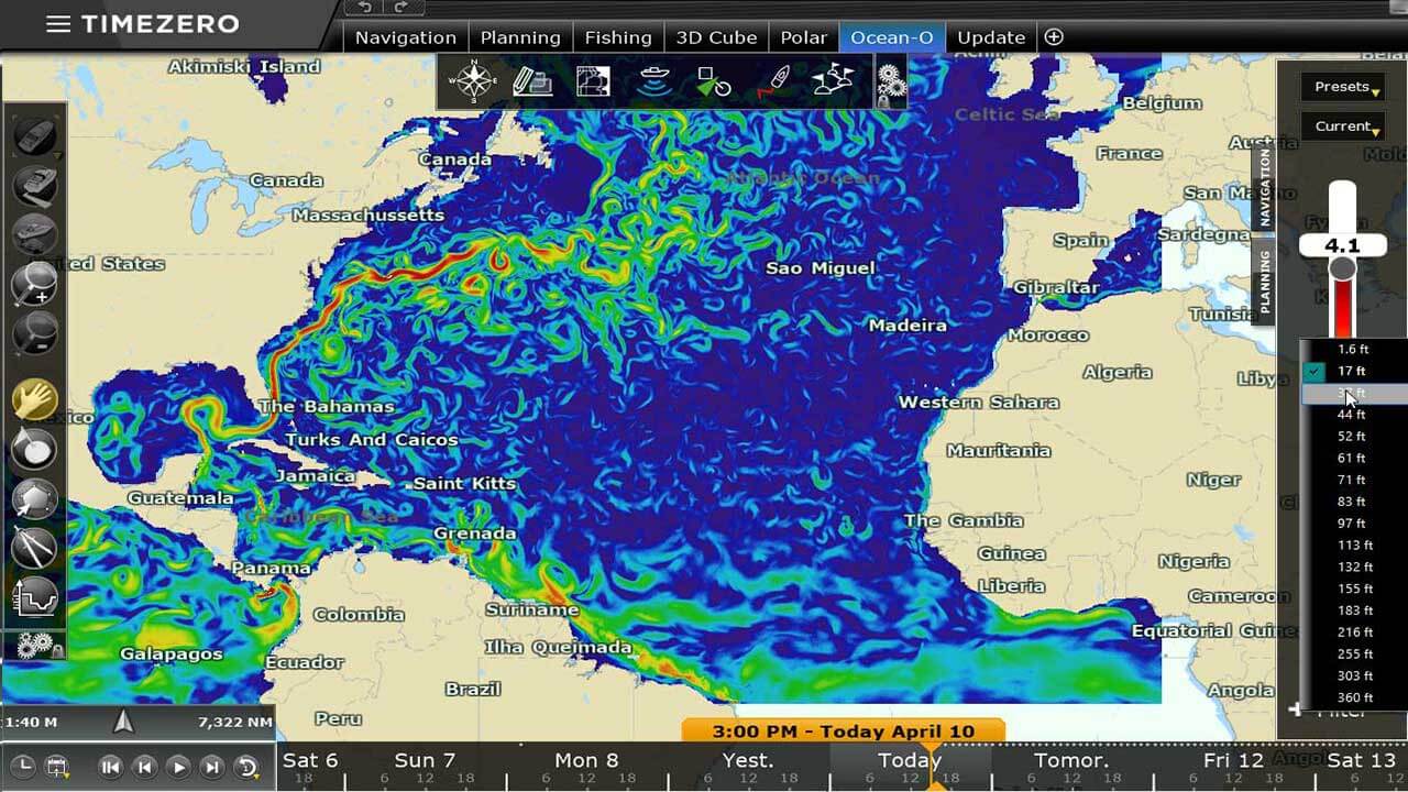
For multi-layered data, it is possible to select the depth at which the data is rendered on screen.
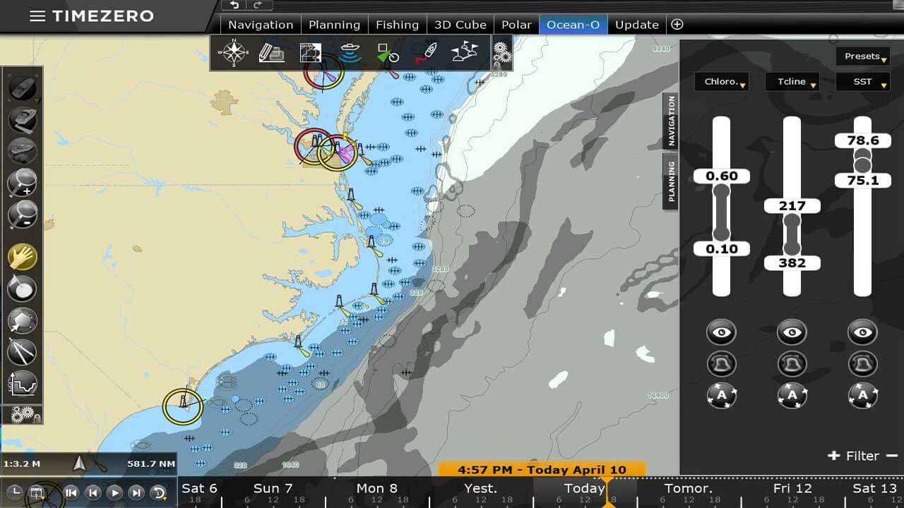
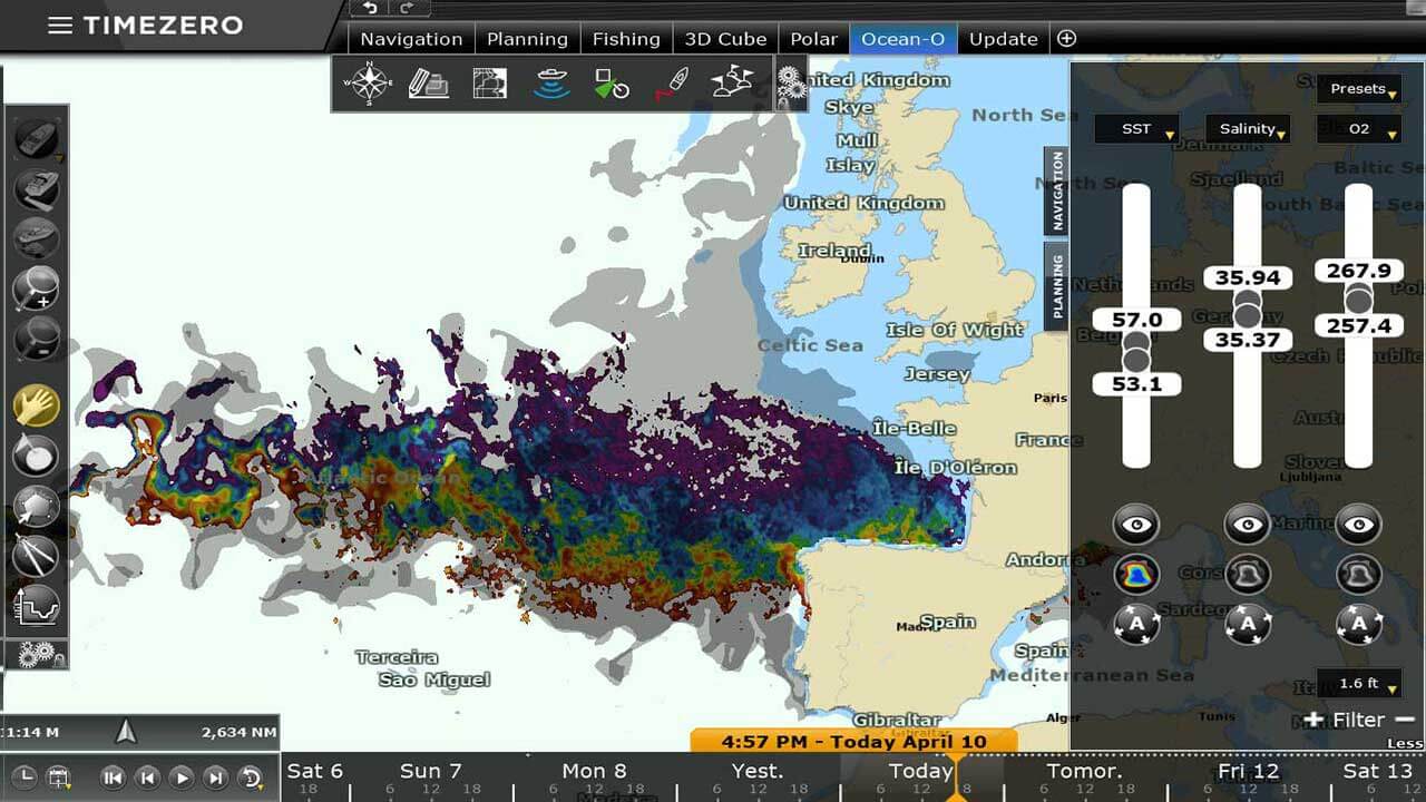
The user can also add and combine multiple types of data at the same time. In this case, a grayscale color is used with a darker shade corresponding to areas that match more parameters. This is an extremely valuable tool to find areas matching multiple criteria targeting specific fish species.
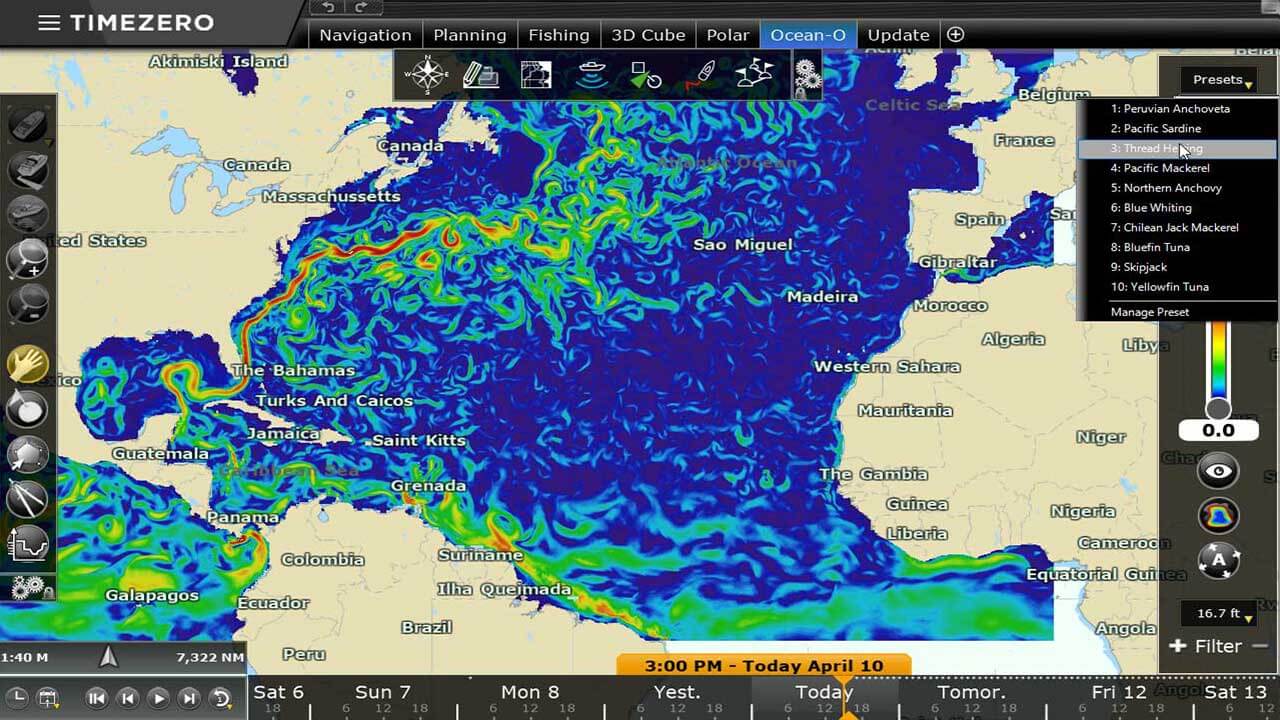
TZ Professional comes with built-in presets (that can be customized) in order to provide an efficient starting point.
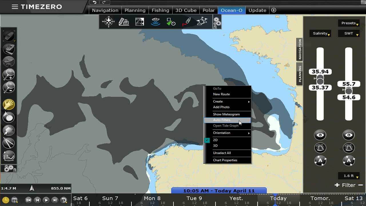
In addition, if you have just made a good fishing campaign and you are satisfied with your catches, a simple right-click will give you access to the Auto Filter cutting-edge feature. TZ Professional will then automatically find any other areas on the chart that match the same parameters. No need to become an oceanographer to use our forecasts. TZ Professional instantly displays the recommended areas!
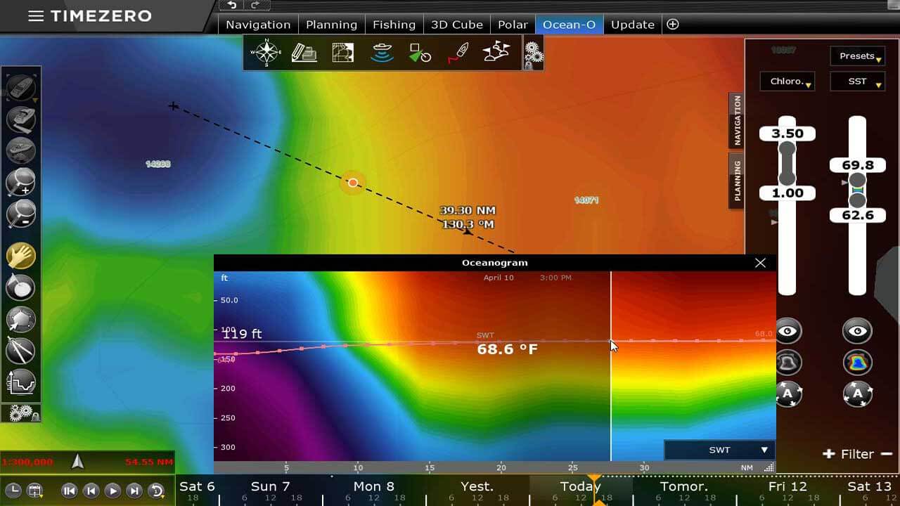
Finally, an Oceanogram window is also available allowing to analyze multi-layer data along a divider line providing a clear view of the water column.
The easiest and most powerful oceanographic forecast filters available in TZ Professional
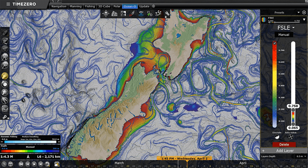
You might already have heard about “Convergence Flow” or “Filaments,” that’s what you can now visualize directly overlaid on your marine chart. Unlike traditional oceanographic data types that directly observe or predict specific variables like temperature, currents, or chlorophyll, FSLE provides insights into dynamic behaviors. FSLE is derived from ocean currents but highlights areas where “stretching” or “convergence” occurs. FSLE helps you target the best fishing potential spots, discover how!
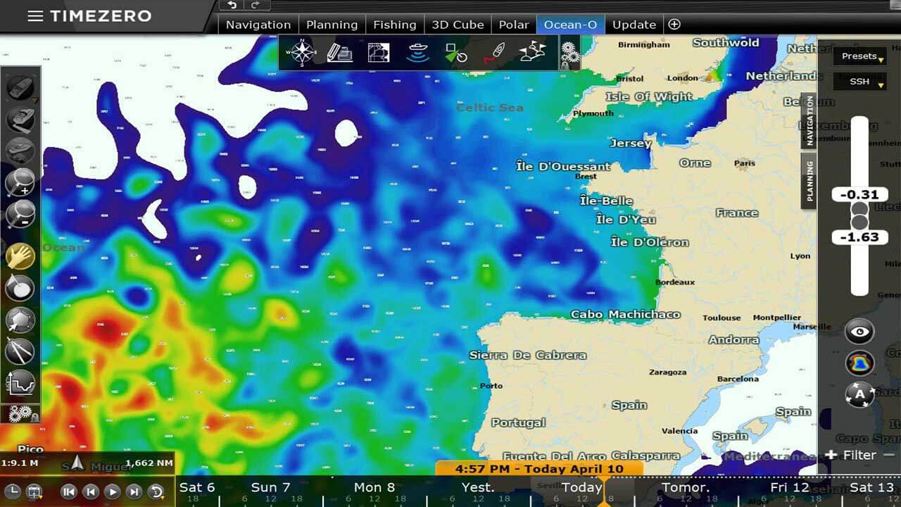
The seas and oceans are not flat. Water levels vary depending on the temperature of the water. Cold waters are denser than warm waters. Pelagic species generally prefer to stay in warm waters (positive altimetry) but nutrients (plankton) are usually found in cold waters (negative altimetry). These species favor the frontal zones. They go to cold waters to feed and then return to warmer areas to warm up.
Once the altimetry data has highlighted a weather front, TZ Professional goes further by displaying additional information such as water temperature, salinity and oxygen; all this according to the depth (3D maps).
Example for Albacore fishing:
Various scientific studies have shown that this species of tuna is generally found in waters between 15°C and 21°C with an oxygen concentration of 1.23 ml l-1. Once on a front zone, just ask TZ Professional how deep is the layer of water corresponding to these 2 parameters and you're done!
The thermocline is the boundary between the deep cold waters and the warmer surface waters. In this zone, significant temperature variations are observed according to the depth. TZ Professional uses a unique calculation algorithm to display thermocline information. The thermocline acts as an insurmountable barrier and varies with depth. If your seine goes down to 150m of depth and if the thermocline is at 200m, the fish can escape by the bottom whereas if the thermocline is at 125m, they will be blocked by this natural barrier and will remain in your net.
Protect your net by predicting shear areas in your fishing zone! With shear data you can display the variations between the strength of the currents from one depth to another. TIMEZERO automatically identifies dangerous areas that can damage your fishing net.