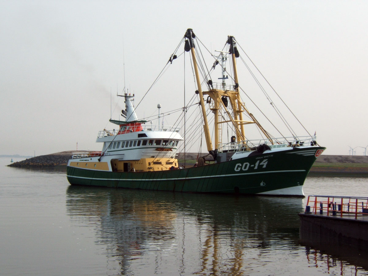
A long line of possibilities opened up to longliners
Longline fishing is atypical and styles varies greatly. To be able to fish on a longliner, one needs an understanding of the sea as well as the fishing zones that are categorized into 3 zones. TZ Professional has the tools necessary so that longliners can define these zones and optimize their strategic choices.
The different types of longline
A longliner is a type of commercial fishing in which a long fishing line is held suspended between two buoys. In some cases, a main longline will have branches of smaller lines running off from it. The size of line can range from 1mile to 60 miles (1.6km to 100km).
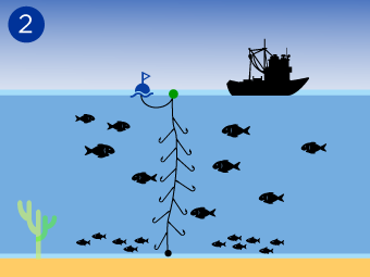
There are 3 types of longline.
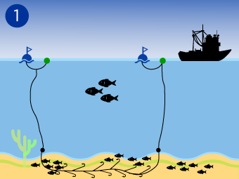
1 Demersal Longline: this type rests on the seabed and targets: sharks, dogfish, batoids, seabream and whiting. Weights are attached to the line to ensure that it sinks to the seafloor.
2 Pelagic Longline: this includes all species living between the surface and the seafloor.
3 Surface Longline: This includes all fish found near the water’s surface, including tuna, marlin and swordfish.
Define your fishing zones in the blink of an eye
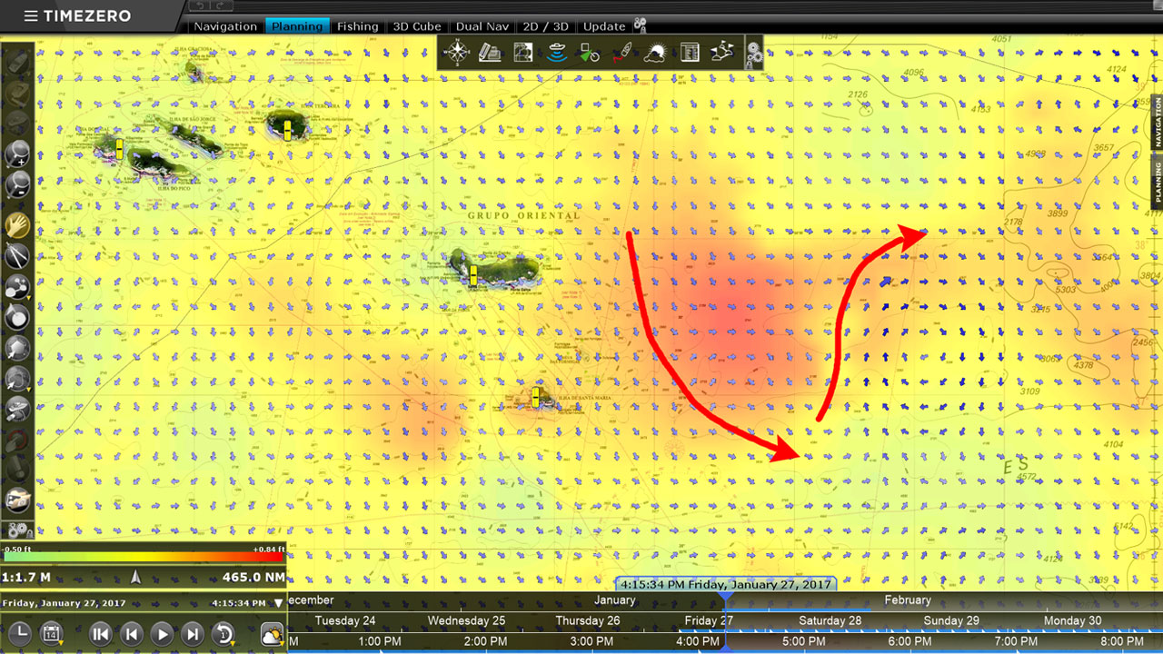
The oceanographic forecasts that are provided free of charge with TZ Professional are particularly useful for pelagic fishing. This is because the surface temperature of the water, geostrophic currents and altimetry all provide indications on where pelagic fish will likely be found and therefore where the best position for fishing gear.
Being able to tap into this data will provide the ability to increase productivity. TZ Professional has the aim to provide targeted zones with the best potential of getting a catch.
Target, optimize and control your fishing area thanks to a unique cutting edge tool.
Optimize the tracking of your fishing zones by saving tracks
TZ Professional allows tracks to be saved in color codes based on water surface temperature (this requires a device to measure surface temperature to be connected to TZ Professional). In one click the track can be saved as soon as the longline is placed in the water and a second click where the longline stops. By color coding longlines it is also possible instantly see the location of various type of species.
This makes it possible to instantly see the temperature of the various zones in which longline fishing for pelagic fish took place.
The recording of tracks is equally as important for the demersal longline fishing. It allows one to identify a fishing zone and to easily retrieve fishing gear.
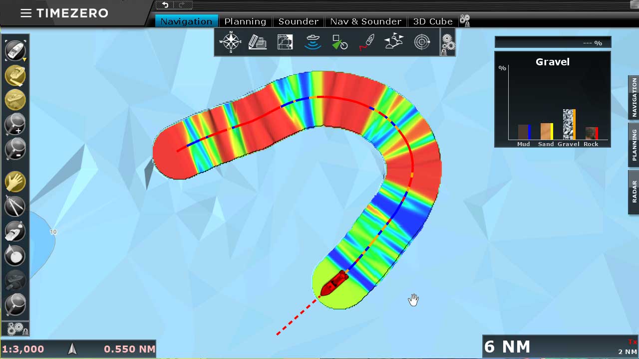
Position you boat with the upmost precision using the PBG module
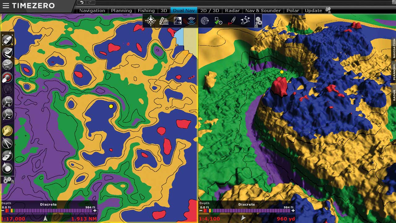
Our PBG module allows precise 3D bathymetry data to be collected and generated on TZ Professional. Once connected to the GPS and sounder, TZ Professional will save a sounder point each second, making it possible to see the seafloor like never before.
Once the fishing zones have been covered, it is then possible to position a longline in between two underwater mounds/cliffs or along the top of an underwater sandbank to optimize the catch.