Professional Software for Seiner
The trick of seiners is to be in the right place, at the right time, since the pelagic species are in perpetual movement. Evidently, this place varies depending upon water temperature and altimetry amongst other factors.
What is a seiner?
A seine boat or drag net fishing boat is a boat designed to use a vertical fishing net that exists in the water with its net held down in the water by weight on one end and its top held up by buoys. It is a fishing method that dates back to the millennia. The most common method is purse seine, where the fish that enter are pushed up towards the top of the net by tightening the rings at the bottom of the net. The fish can then be hauled up efficiently onto the boat.
This technique is most advantageous for pelagic fish (fish that live mostly close to sea level) such as tuna, sardines and anchovy. It is very much a selective style of fishing because each specific target will be found in a certain area at a certain time of year and are often found bunched together in shoals meaning that this is one of the most effective fishing techniques for these fish.
Because of the unstable fishing area, the only routine of seiners is identifying strategic spots.
Because efficiency is a central matter
The founding fathers of seine fishing would typically set out with sounder technology in the hope that they would stumble upon a shoal of fish. With TZ Professional, it doesn’t have to be a wild-goose chase. Instead, use the built in features to receive oceanographic data, allowing you to focus your attention on zones with the highest probability, which will save you time, gas, and money.
What are Geostrophic Currents?

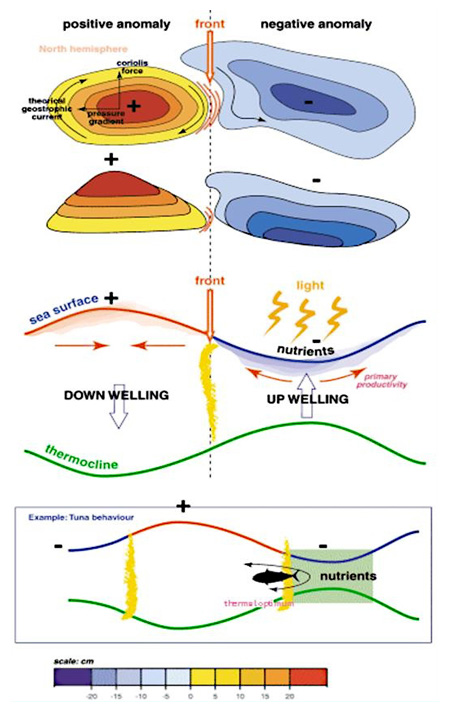
A geostrophic current is an oceanic flow in which the pressure gradient force is balanced by the Coriolis effect.
The direction of geostrophic flow is parallel to the isobars, with the high pressure to the right of the flow in the Northern Hemisphere, and the high pressure to the left in the Southern Hemisphere.
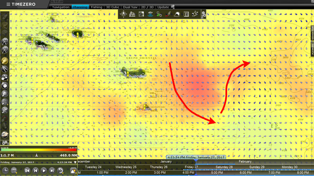
The currents that are provided by the Altimetry feature only take into account the ocean topography and they don’t take into account the effect that wind has on water. Geostrophic currents are closely linked to altimetry and provide important information on the degree of oceanic activity and the potential route taken by schools of fish such as anchovies, mackerel, sardines, tuna, swordfish, etc.
In the example above, the arrows (marked in red) highlight that there is a close relation between Altimetry and geostrophic currents. This way, you can instantaneously define your fishing spot with TZ Professional.
How to be the first mover to a spot?

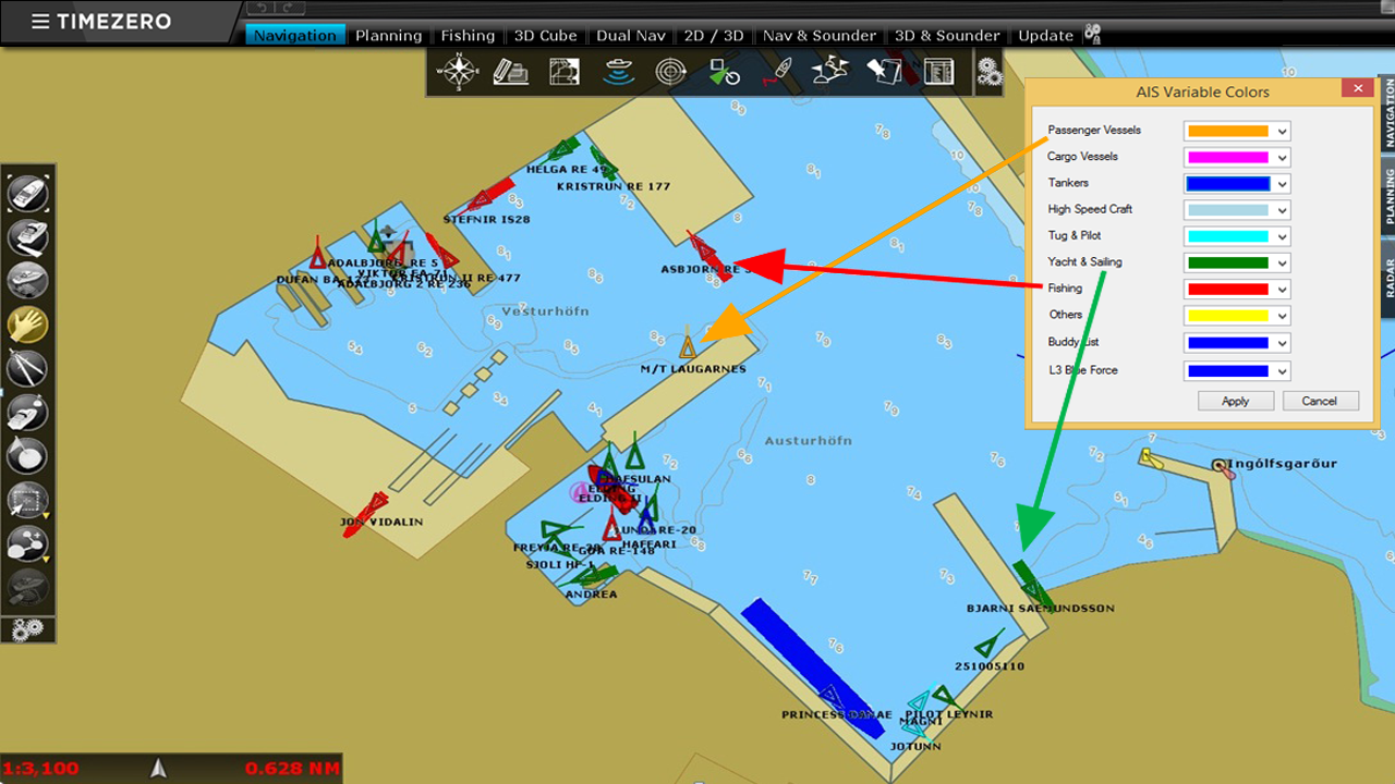
Once connected to an AIS receiver, TZ Professional displays on the chart the complete list of boats found in the vicinity and can even save target tracks. It is really easy to see where other seiners are located and keep a close eye on them. Thanks to this information, you can navigate directly to still virgen fishing areas.
TZ Professional also gives you the possibility to display the different types of AIS targets in different colors. The boats “friends” can for example be displayed in green while the others could be in red.
